What Are Starlink Trains and How Do You See Them?


Andreas Rivera
Jan 10, 2025
Icon Time To Read3 min read

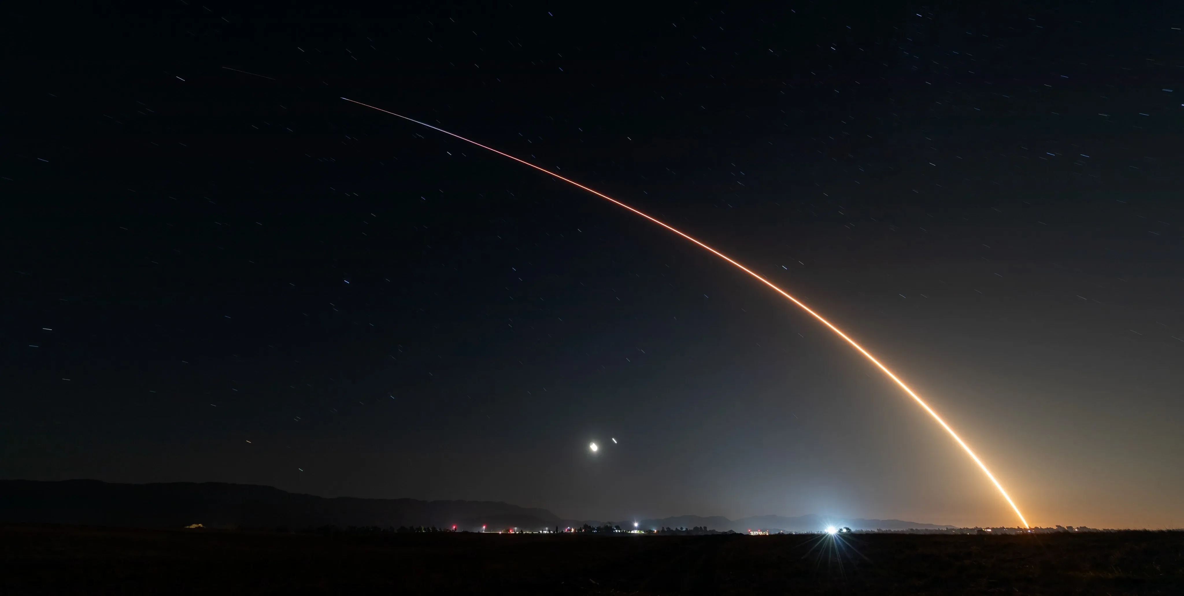
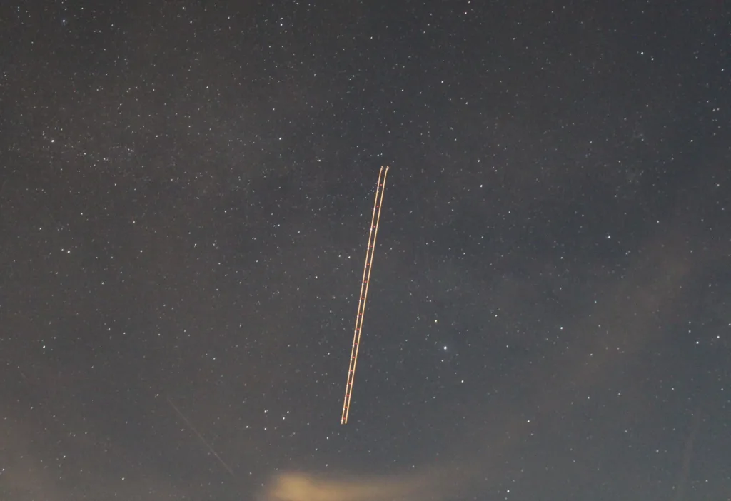
Long exposure shot of a Starlink train of satellites. When first deployed from a rocket, Starlink satellites ascend to orbit in a straight line | Image by Wirestock via Getty Images

That bright parade of lights making their way across the night sky aren’t UFOs but a train of Starlink satellites orbiting the Earth. With about 7,000 satellites in orbit and counting, have you ever been curious about observing a Starlink train? The “mega-constellation” makes Starlink’s high-speed, low-latency satellite internet possible.

Fortunately, plenty of resources are available for the curious who’d like to pinpoint satellites in the night sky. You can also track whenever SpaceX launches a batch of satellites about its Falcon 9 (and soon on the much larger Starship).
Here are a few tips for spotting satellites:

  • It should go without saying that it needs to be a clear sky to spot any celestial object.
  • You’ll be hard-pressed to see much at night from populated, light-heavy areas like cities. You’ll have better opportunities to see spacecraft in rural, dim areas.
  • The best times to spot satellites are right after sunset and before sunrise. This is because the Sun is close enough to the horizon to reflect its light off of the satellites. 
  • If you want to photograph Starlink satellites, you’ll have the best luck using a camera with a long exposure feature

What’s a Starlink Train?

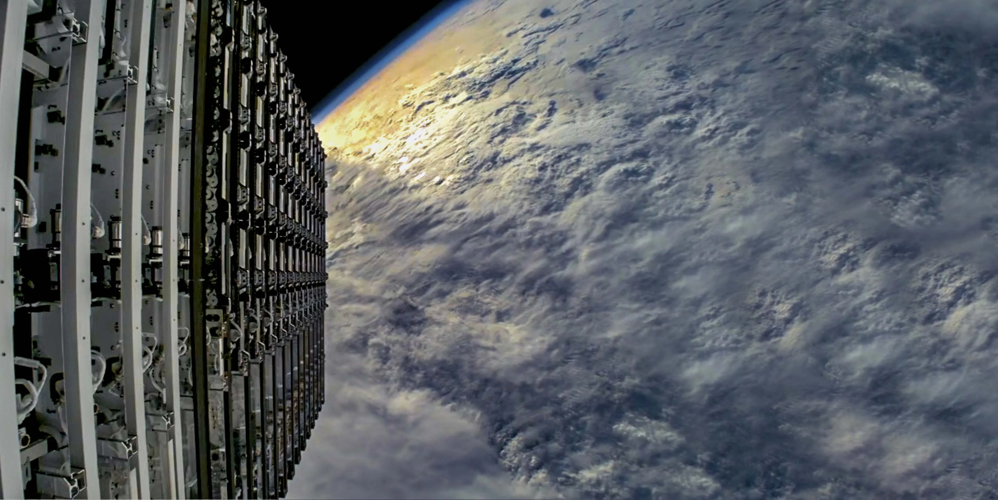
Photo from a Falcon 9 spacecraft about to deploy a group of Starlink satellites. | Image by SpaceX

When observing the sky, you may see the rare sight of a long parade of moving lights across the night. When SpaceX launches a fresh batch of Starlink satellites from the Falcon 9, they’re released in a line and continue along the same continuous path as the satellites gain altitude. Once they reach their targeted height, the satellites go in separate directions. If you want to see a Starlink train, your best chance is during the next few evenings or mornings after a launch.

Starlink Launches

The times and dates of launches from the U.S.’s handful of launch sites are rarely announced more than a few days in advance. Weather and mechanical issues constantly reschedule launches, so it’s impossible to guarantee a set launch time. Here are some sites that have up-to-date scheduling information for upcoming SpaceX and other launches. 

Track Starlink Satellites

Because Starlink shares the sky with other satellite constellations and spacecraft, its satellites' locations and trajectories are transparent. The U.S. Space Force and North American Aerospace Defense Command (NORAD) release this information publicly so satellite operators and government organizations can coordinate to avoid interference or collisions. 

Private organizations have taken advantage of this public data to create ingenious tools for anyone to track satellites. Here are some of our favorites:

This website, run by respected astrophysicist Johnathan McDowell of the Harvard-Smithsonian Center for Astrophysics, contains a wealth of satellite stats and history. It’s regularly updated with new data on everything orbiting our planet, including a running tally of every Starlink satellite

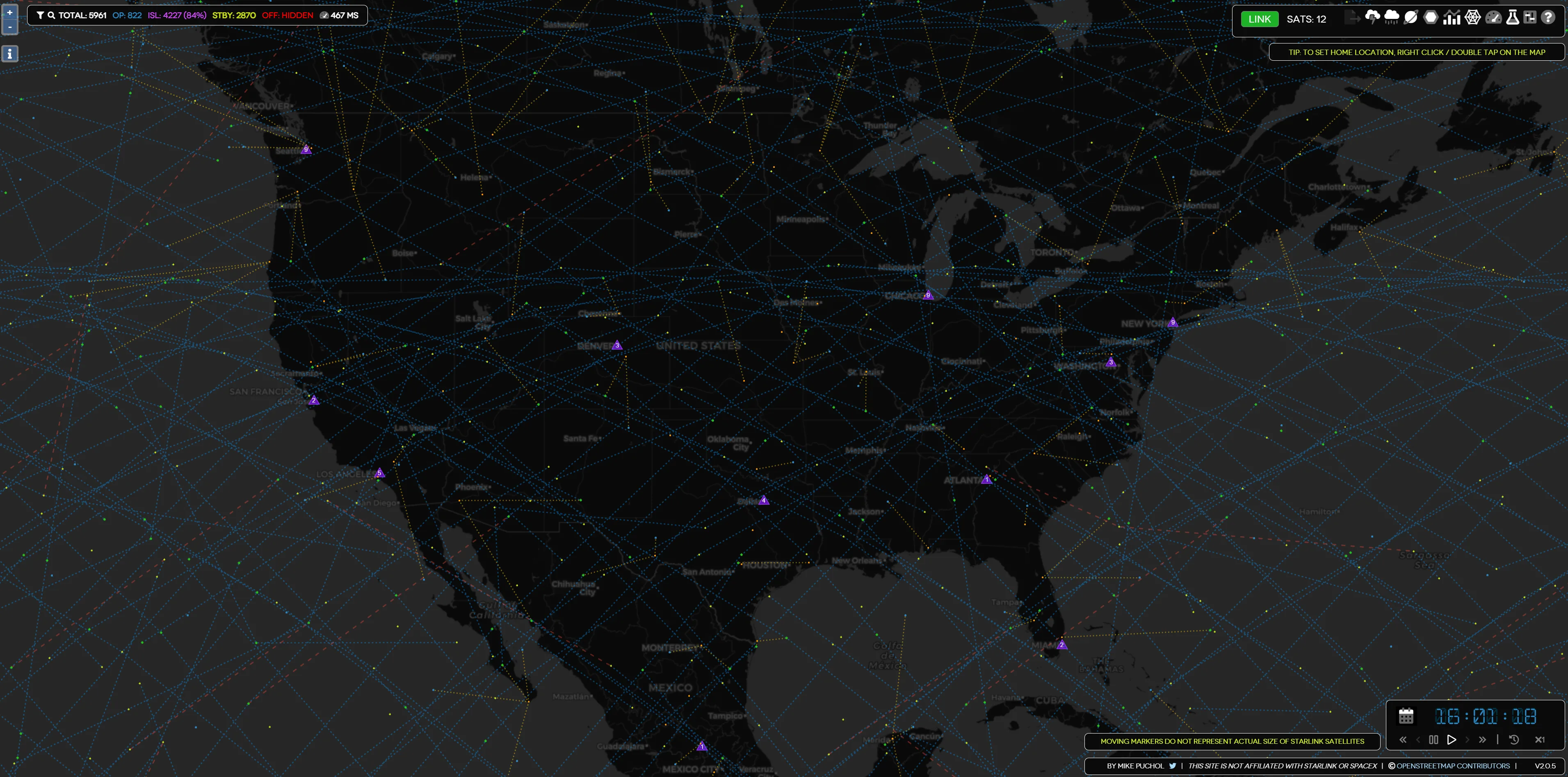
A real-time simulation of Starlink satellites orbiting the planet. This simulator is unique in that it also depicts how individual satellites communicate with each other and the ground stations connecting Starlink customers to the internet. It’s a fascinating tool that helps Starlink customers understand the type of coverage they’re getting.

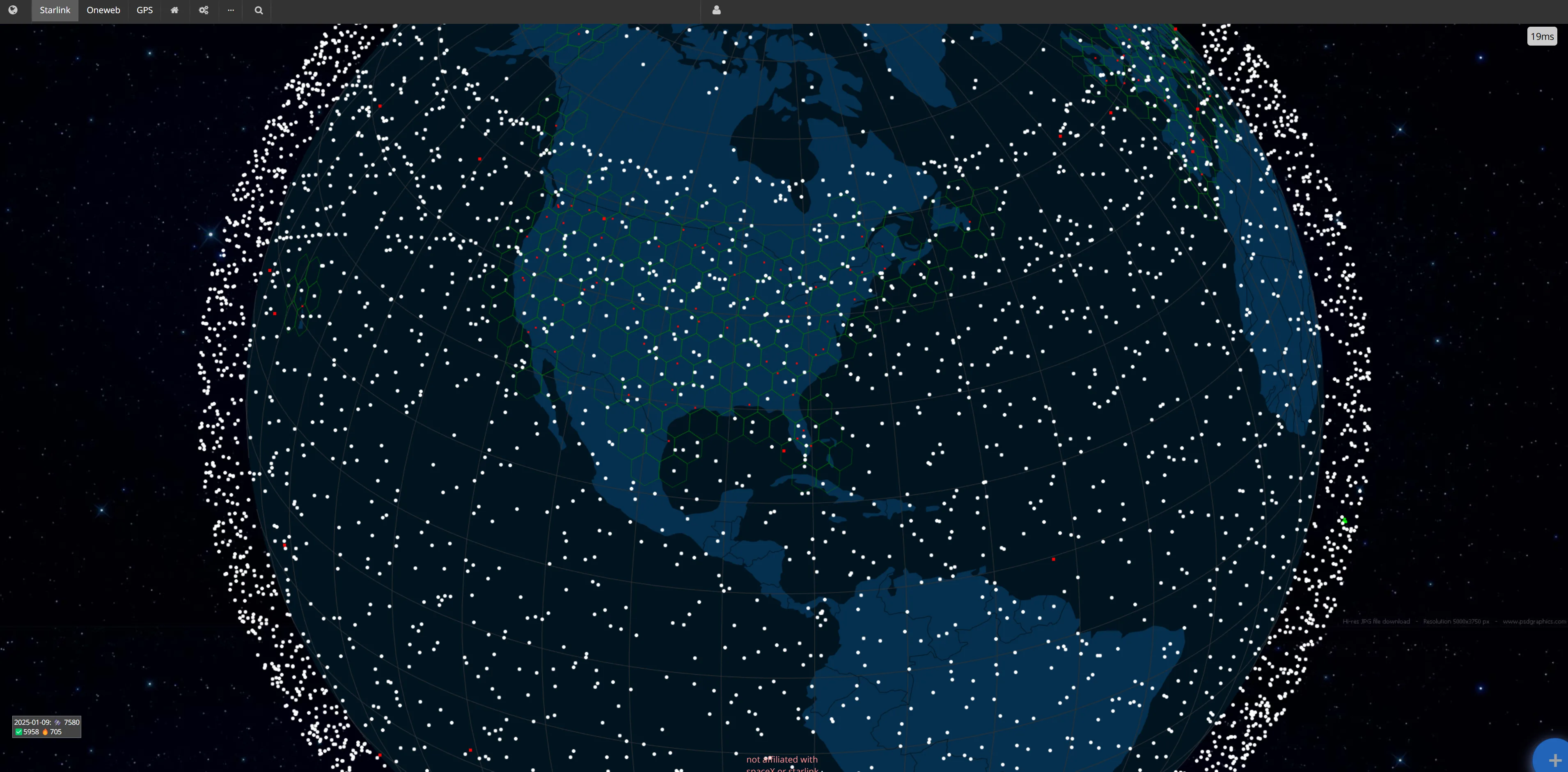
This is another simulation that depicts the thousands of Starlink satellites spinning around the globe. The scale puts into perspective just how many satellites dot the night sky. The map allows you to see individual satellites' projected orbit, including their grouping. This makes it easy to see what satellites are passing over your location and when you can expect the next ones. As a bonus, you can also see where the International Space Station and Chinese Space Station are in orbit.

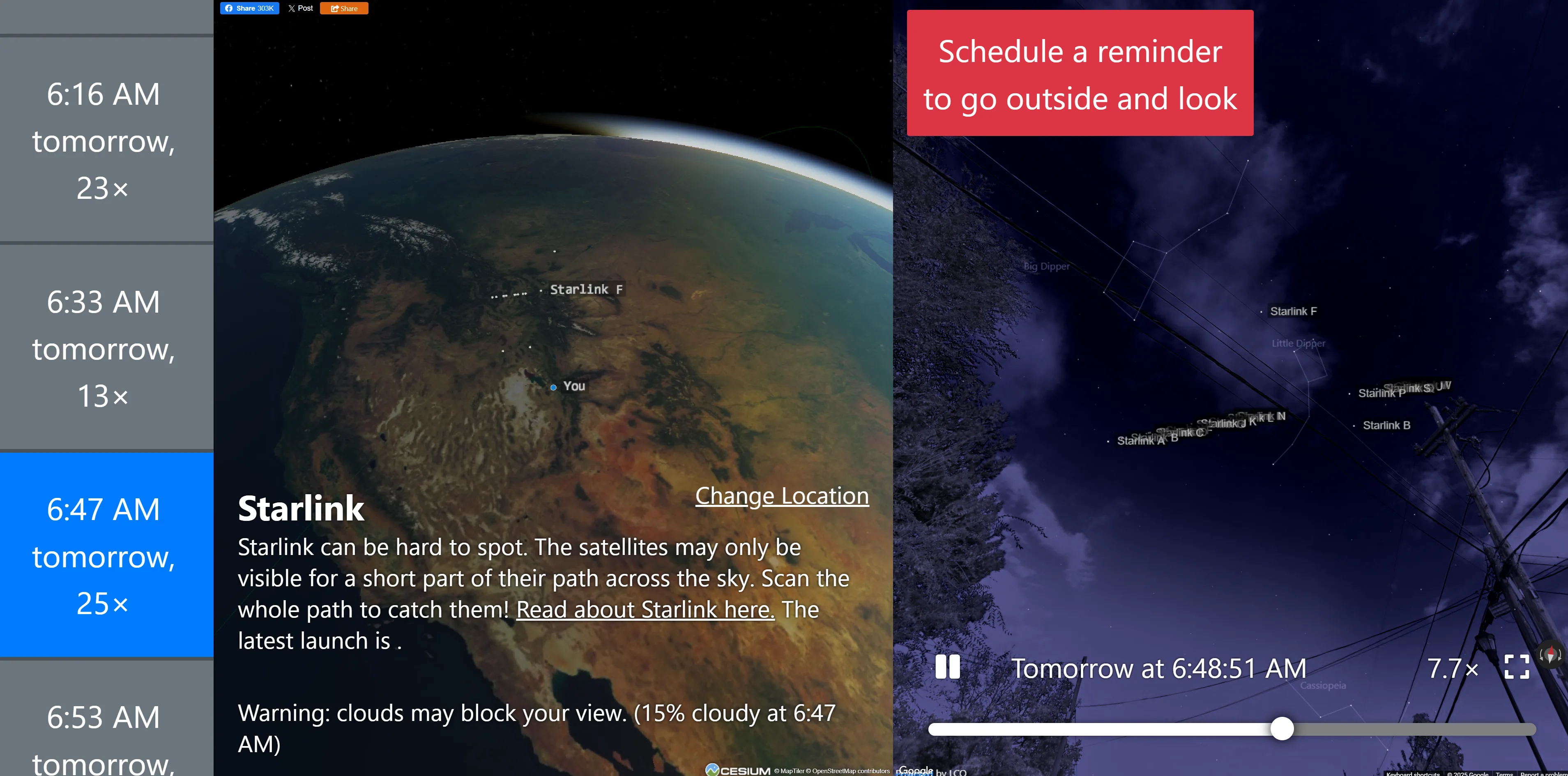
When you’re serious about seeing a satellite in the night sky, there’s no better tool than this satellite tracker created by former Google engineer James Darpinian. The application uses your location to calculate the best times to see satellites overhead. Allowing you to easily see when the best time is to start satellite gazing. It even uses Google Street View to simulate where the satellites will appear in the sky. This tool will quickly help you spot Starlink trains. You can even set a reminder for when it’s time to look up.

Interested in Starlink? Find out what makes it the fastest-growing satellite internet provider.

Andreas Rivera
Written by
Andreas Rivera is a lifelong writer with a decade-spanning career in journalism and marketing. He comes to SatelliteInternet.com with several years of experience writing about business and technology. His passion for researching the latest advancements in tech, especially the now essential need for reliable internet access, fuels his goal of educating others about how these innovations affect and improve our everyday lives. When not researching and writing about SatelliteInternet.com, you’ll likely find him buried in a good book or enjoying the great outdoors with a fishing rod.